I went down early last week to New Orleans and began coordinating a citizen aerial mapping effort with the Louisiana Bucket Brigade (LABB) using my recent research in low-cost balloon and kite-based aerial imaging. Our efforts have begun to bear fruit, as almost daily trips into the Gulf are bringing back stunning imagery:
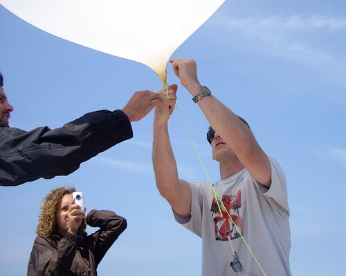
On Sunday May 9, Stewart Long, Shannon and Mariko from LABB, and several other volunteers made it to the Chandeleur islands on a boat and in 9mph winds were able to image the slick making its way through the island chain. There appeared to be no booms in place at that location. In the above image you can see their boat and the tether for the balloon. (Thanks to Jim Smith at UptownAngler.com and Spencer Moss at FishingGuidesWorld.com for getting us on a boat.)
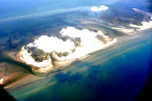
We’re also getting free rides in small planes; the below image shows bands of orange tar/oil washing up on Chandeleur, as well as clouds of iridescent oil in the deeper water:
About the project
We’re helping citizens to use balloons, kites, and other simple and inexpensive tools to produce their own aerial imagery of the spill… documentation that will be essential for environmental and legal use in coming years.
We’re not trying to duplicate the satellite imagery or the flyover data (though we’re helping to coordinate some of the flyovers and trying to make sure the data is publicly accessible). We believe in complete open access to spill imagery and are releasing all imagery into the public domain.
Read more here and access our public domain datasets